The circa 17.97 hectare site is located on the eastern edge of Hagley within Bromsgrove District. It lies to the south of Western Road and to the west of the A491. It comprises two agricultural fields split by an existing bridleway. Established woodland forms the southern boundary of the site, while to the west lies the residential edge of Hagley, as well as agricultural land.
The site has predominantly been in arable agricultural use and is therefore of relatively low biodiversity value. However, there are higher value habitats comprising existing hedgerows and a small copse of mature trees which will be retained as much as possible and enhanced with additional habitat creation as part of the extensive green infrastructure proposals for the development.
Local amenities are situated to the northwest of the site and to the west of the A456. All facilities are within suitable walking distances (up to 1.6km walking distance) and include schools, local shops, railway station and community centre. Hagley Train Station is located approximately 15 minutes walking distance from the site and provides frequent services to Worcester, Kidderminster and Birmingham.
The site is currently located within the Green Belt, however it occupies a highly sustainable location for development on the existing settlement edge. For this reason it has been promoted as a grey belt site to meet housing need in Bromsgrove District. The site was identified by the council as a potential option for residential development in a Draft Development Strategy which will inform the emerging new Bromsgrove Local Plan (site reference HAG02).
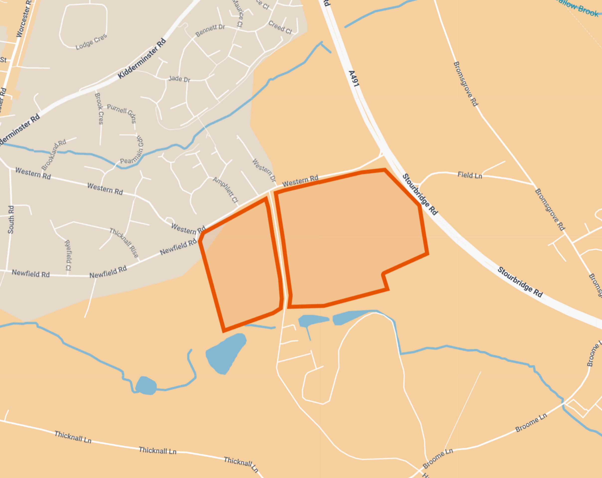
A plan showing the location and approximate extent of the site – Click to enlarge